

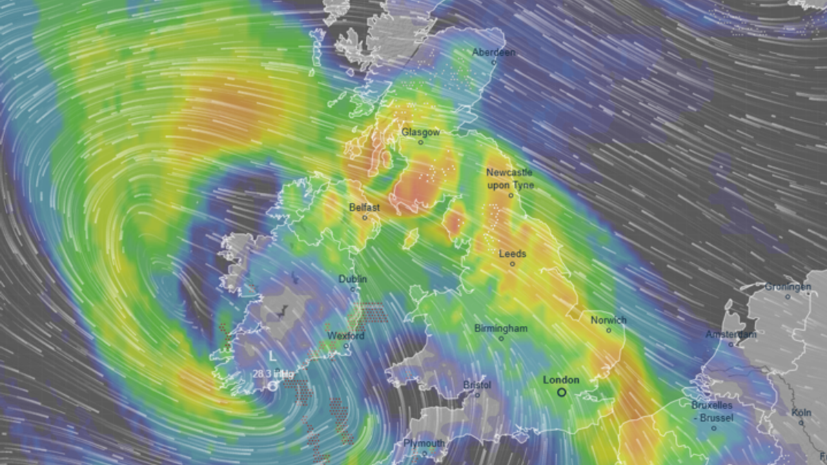

Met Éireann, the Irish meteorological service, has issued a severe warning to residents, advising them to prepare for a second onslaught from Storm Chandra. The immense low-pressure system initially struck the Republic of Ireland with heavy rain and strong winds, but experts are cautioning about additional impacts as the storm loops back.
According to the national weather service, a band of persistent rain is expected to move up from the southeast, leading to widespread rainfall. As the system progresses northward, it will encounter cooler air, potentially resulting in mixed precipitation, including sleet in elevated areas of the north and northwest. After the initial rain clears, a brief period of drier weather is anticipated before the storm returns, bringing more rain across the country, particularly affecting southern and eastern regions with significant rainfall.
Currently, two weather alerts are active across the island, set to last until midnight. A Yellow wind warning, initially covering seven counties, has been extended to encompass the entire nation until 11 pm. Additionally, a Yellow rain warning is in effect for specific counties until the same time.
Described as a “multi hazard event,” the forecast warns of flooding, power outages, fallen trees, and hazardous travel conditions. To prepare for the storm, Met Éireann advises households to ensure their mobile devices are fully charged and to have local emergency numbers saved.
As of 11 am, around 20,000 properties in Ireland are without power, with reports of flooding incidents in Dublin. Dart services have faced disruptions, and numerous ferry crossings between Dublin and Holyhead have been canceled. Dublin Airport has also cautioned about potential flight cancellations.
Met Éireann forecaster Rebecca Cantwell stated that Storm Chandra, a low-pressure system moving northward, will bring wet and windy conditions, heavy rain, and strong winds, especially along the coast. Given the already saturated ground and rising river levels, localized flooding is expected, particularly in southeastern counties. The combination of wind and rain will create challenging travel conditions, especially along coastal and exposed areas.
In summary, residents are urged to stay cautious, keep away from rivers and coasts, avoid flooded roads, and follow guidance from local authorities and road agencies to ensure safety during the storm.